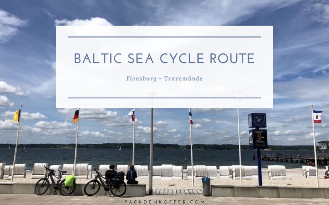
Baltic Sea Cycle Route Experiences
Basic about the baltic sea cycle route
The Baltic Sea Cycle Route or Baltic Sea Coastal Cycle Route was the result of a very brief discussion about Corona and safe and enjoyable holidays. We always wanted to go on a cycling holiday anyway and so it was obvious to take this beautiful cycle path from Flensburg to Travemünde on the coastline of Schleswig-Holstein in the north of Germany. You can read on this blog post about the different sections of the Baltic Sea Coastal Cycle Route along the Schleswig-Holstein coast and also our recommendation for stopovers and places of interest. Spoiler: after just about 360 kilometres on the bike, we can already say in advance that it was one of our greatest holidays. The Baltic Sea Cycle Route is, by the way, part of the European Cycle Route EV10, which leads you once around the Baltic Sea with a total distance of almost 8000 kilometres. If you already like this short part, you can of course extend the route around the Baltic Sea much further.
Preparations for the cycle tour on the Baltic Sea Cycle Route
Before we talk about the individual sections, we would like to tell you a little bit about the preparations. We have planned the route in advance using Google Maps and Naviki. Google Maps already has a great navigation for cyclists. The app Naviki (Playstore Link / iOs Link) is especially designed for route planning by bike. The combination of both apps has really helped us a lot.
Bicycles, e-bikes and pedelecs on the Baltic Sea Coast Cycle Route
On the way it will be very hilly and probably more hilly than you would imagine Schleswig-Holstein and the Baltic Sea coast. We are travelling with pedelecs ourselves. There was a small, pleasant advantage with the pedelecs in the form of electrical support. In contrast to other tours, the advantages of the motors were particularly evident here. Especially during the first stages we were at the upper end of the battery range of our bikes. So in flat sections we usually rode with less assistance to save battery power. Only on the hilly sections we used the full support. In all accommodations it was possible to charge the battery in the evening without problems. An anecdote by the way: an accommodation listed by the ADFC wanted to charge 3 Euro each for charging the battery. Sorry, but that is going too far.
Hotels and guesthouses – Accommodation at the Baltic Sea cycle track
Due to Corona and limited hotel capacity, we recommend that you plan your route in advance. Our initial idea was to book the hotels or guesthouses spontaneously along the Baltic Sea Cycle Route, which did not make sense after a short check 2-3 weeks in advance. Without a booking, the offers are limited and expensive. With a tent in your backpack, you will certainly be much more flexible with the many campsites along the Baltic Sea Cycle Route.
Our journey to the Ostseeradweg
We travelled to Flensburg by train, which worked very easily so far. Make sure that you have enough time to change trains at the stations. Especially on weekends with a lot of traffic, 20 – 30 minutes with a packed bike and the available lifts at the stations are not a long time. With the “Quer durchs Land” ticket for two persons and two bicycle day tickets the journey cost 62€. Unbeatable cheap compared to travelling by car and the related parking fees etc.
Bicycle and luggage – one week Baltic Sea coast cycle track
About the luggage: we took our stuff in two medium sized bags (Affiliate Link to Amazon: Ortlieb and Vaude bags ). In retrospect, we honestly had too much luggage for the one week on the Baltic Sea cycle route. The weights were 11 and 14 kilos, which was already packed relatively luxuriously. With the next tours we would reduce the weight again substantially. In all accommodations we could have also washed the bike clothes in order to save more weight. Let us consider it as part of the learning curve 😉

Our seections on the Baltic Sea Cycle Route
Section 1 from Flensburg to Maasholm – approx. 65 km
After a trip of almost three hours we reach Flensburg by train. From the train station we first go quite directly into the city centre towards Hafendamm and then on the right side of the harbour directly onto the Baltic Sea cycle route. A small sign with the inscription “Ostseeküstenradweg Schleswig-Holstein” should always (mostly) show you the way. After a short start at the waterfront we ride relatively fast through the city again until we reach Glücksburg after a few kilometers. In Glücksburg the first stop is at the water castle. Alternatively, and just as we did: directly at the promenade with a view of the Flensburg Fjord. Our motivation was high and so we continued quickly through the Pirner See nature reserve towards Bockholm, Langballigholz and then on towards Niby.
On these first kilometers you don’t get in contact with the Baltic Sea very often, but fortunately this changes much on the further way. The way leads via Norgaardholz passing the Steinberg Haff and then follows the Baltic Sea directly. In the truest sense of the word: the Baltic Sea cycle path. After just about 65 kilometres we reached our guesthouse near the village of Gut Oehe near Maasholm, satisfied and happy. The conclusion of the first day: Schleswig-Holstein is a very hilly state and the Baltic Sea coast cycle route is already a very great experience. For your planning, we recommend accommodation in Maasholm (Affiliate Link – Booking – Maasholm). Maasholm is located directly on the Schlei and is an old fishing village with beautiful alleys. Especially in the evening hours a great place to relax on the waterfront.
Section 2 from Gut Oehe to Altenholz close to Kiel – approx. 80 kilometres
With charged batteries we started on day 2 after an extensive breakfast on the Baltic Sea cycle route again. First break: the small town of Kappeln on the Schlei. It was still too early for a coffee stop and so we went directly on towards Olpenitz village. Our first stopover after a few beautiful kilometers along the Baltic Sea was the holiday resort Damp. Apart from a big ugly hotel complex there are also some nice cafés in Damp at the harbour, which are very good for a stopover. Highly motivated we went on towards Eckernförde (about 40 kilometres). We were told that many cyclists on the Baltic Sea cycle route also stop over in Eckernförde for an overnight stay. (Affiliate Link – Booking Hotels in Eckernförde) On the other side of the Eckernförde bay we continued via Grünwold, Schwedeneck and Dänisch Nienhof towards Altholz in front of Kiel.
Section 3 from Altholz to Lütjenburg on the Baltic Sea cycle path – approx. 75 kilometres
After the first two great sections we hadn’t thought that we would see any further improvements on the Baltic Sea cycle route. Section 3 convinced us then completely. Directly after our start we crossed the Kiel Canal on the Holtenauer high bridge. Alternatively, you could also cross the canal directly by ferry, which starts in Holtenau. Surprisingly, on one of the most frequented channels worldwide there was absolutely no operation at all this morning. The detour to the viewing point at the eastern part of the channel was therefore not worth it. From the Kiel canal we headed along the Kieler Fjord towards Kiel city centre. If you orientate yourself at the waterside you can cycle directly along the “Kiellinie“, a kind of promenade, into the city centre.
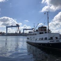
From the distance you can already see the ferries to the Baltic and Scandinavia, which leave directly from the piers in the city centre. On the other side of the Kieler Fjord you will discover large shipyards and industrial areas, which also characterize the cityscape of Kiel.
Via Heikendorf and a short stop at the submarine memorial Möltenort we continued our journey in direction to Laboe. Also in Laboe there is a navy memorial and an exhibited submarine, which you can visit. The route now leads you from Heikendorf only in the direct surroundings of the Baltic Sea so that the Baltic Sea cycle track lives up to its name. In some places the official cycle route will lead you back inland. At these places we often continued on the way directly at the water, which was also good to cycle in most cases.
Along the coast via Wenndorfer Strand the cycle path also leads along the small towns of California and Brazil. After a few more beautiful kilometres along the Baltic Sea, the cycle path near Hohenfelde takes us back inland. With a last view of the Baltic Sea at Hohwacht we headed towards Lütjenburg to complete the third day. This section of the tour from Flensburg to Travemünde on the Baltic Sea cycle route is certainly one of the most beautiful sections for us.
Section 4 from Lütjenburg to Burg on Fehmarn – approx. 65 km
The hilly end of section 3 also meant a hilly start in section 4, and we wanted to finally tie up directly at our exit point at the Baltic Sea in Hohwacht in the morning. Said and done, and so we went in Hohwacht through the Sehlendorfer Binnensee nature reserve and directly back onto the Baltic Sea cycle route. This section should also be as exciting as the previous sections with the Baltic Sea, hills and forests. After a few kilometres we reach Weißenhäuser Strand, a resort that certainly has seen its best days a couple of years ago. Immediately after Weißenhäuser Strand, the cycle path turns inland for a short while due to an area of the German Armed Forces, so that we could only reach the Baltic Sea again via Holstein in East Holstein and Teschendorf. You will notice that the towns on this section are already much bigger and more touristic than the small fishing villages on the first two sections.
After a short break directly at the Baltic Sea, you will head directly to Heiligenhafen. Our first impression of Heiligenhafen was quite sobering, as we have been welcomed directly by a building complex from the 70s at the entrance of the village. This is supposed to be a great holiday resort? It’s best to continue directly at the coast. You will quickly reach the newer and much more beautiful Heiligenhafen, which shows a completely different picture.Take your time for the pier Heiligenhafen and the small pedestrian zone and then ride to the port of Heiligenhafen. You will see many small restaurants and cafés where you can stop for a break. Our recommendation in Heiligenhafen is the Imbiss Ostsee-Fischer, which serves super delicious fried fish. Well refreshed we made our way from Heiligenhafen to Großenbrode on the Fehmarnbelt.
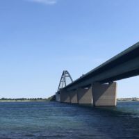
We had already crossed the Fehmarnsund bridge several times by car but never by bike. The arquitect of the Fehmarnsund-Bridge probably did not have a bicycle and therefore, he did not plan to cross the bridge by bike. So you go on a service track to the bridge and there on a rudimentary bicycle path over the bridge. After crossing the Fehmarnsund we were already very close to our destination Burgstaarken on Fehmarn and the last kilometres cycled on their own.
Stopover in Burg on Fehmarn
We used day 4 for a stopover in Burg on Fehmarn. From the port of Burgstaarke it is about 2 km to the city centre of Burg and about one and a half km to the south beach. The village of Burgtiefe can easily be identified even from a distance by the three “beautiful” hotel complexes, which are now even listed as protected buildings. In the seventies, this complex was an architectural masterpiece. From the beach with a view to the Fehmarnsund, these ugly buildings fortunately do not block the view. We spent the day very relaxed in Burg and at the south beach. If you are highly motivated, the official Baltic Sea cycle route takes you another hundred kilometres along the coast of Fehmarn. We have saved this bonus round for a future holiday. 😊
Section 5 from Burg to Pelzerhaken – approx. 63 kilometres
Crossing the Fehmarnsund Bridge did not change on the return trip. There was no major cycle path built overnight. South of Großenbrode we keep along the Baltic Sea and pass the holiday resort Dahme via small villages like Sanaa and Süßau, pass the villages Kellenhusen and Grömitz before we arrive via Rettin in Pelzerhaken. On this section you will already see the much larger and well-known holiday resorts. The Baltic Sea cycle route often passes these places by completely without notice. Nevertheless take your time and get off your bike to have a look at the promenades of the villages.
Section 6 from Pelzerhaken to Travemünde – about 30 kilometres
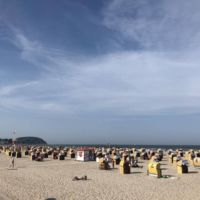
The last section of our tour along the Baltic Sea Cycle Route should also be the shortest section. The route led along the Lübeck bay from Pelzerhaken via Neustadt, Sierksdorf, Haffkrug, Scharbeutz, Timmendorfer Strand, Niendorf and the Brodtener cliffs to Travemünde. The cycle path along the bay is very well prepared. The holiday resorts along the bay are strung together like a string of pearls and are directly connected to each other.
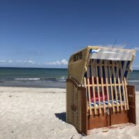
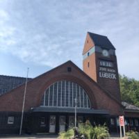
The last stage is characterised by the image of the large holiday resorts and their wide beaches. The Brodtener steep coast offers a natural contrast here. After nearly 360 kilometres we have reached our destination on the wide promenade of Travemünde. The place is a great ending for this holiday. You can certainly make a good stopover here before continuing eastwards on the other side of the Trave on the Baltic Sea cycle path.
From Travemünde station, which is only a few hundred meters away from the beach, we went back the next day by train with no problems. In the Lübeck Bay it is also much easier to find accommodation than on the first stages. Just look for hotels in Travemünde via the following link (affiliate link to Booking.com – no extra costs for you)
One week holiday on the bike – Review Baltic Sea Cycle Route
If you are considering a cycling vacation, we can warmly recommend the Baltic Sea cycle route from Flensburg to Travemünde. We have been surprised in a very positive way. On the first sections you will cycle through incredibly beautiful landscapes and see many small villages. On the last sections, the scenery will be much more touristic, which will also guarantee a lot of variety. The Baltic Sea cycle route is relatively well signposted and on most routes well prepared. If we would ride the tour again we would set the stops a little bit different. For overnight stay we would then consider bigger places like Eckernförde or Kiel. After a week on the bike, we are convinced that we will be able to enjoy a cycling holiday in the future and are looking forward to the next tours, about which you can certainly read here. Maybe the Weser cycle path is also something for you? Just have a look here…
Which cycling holidays have you done and what can you recommend? Just tell us about it in the comments!
We like to recommend you following items for your time on the Baltic Sea route, which will help you for sure.
Sunscreen. The constant light wind hides the sun’s power.
Bicycle repair kit. There is nothing more annoying than standing in the middle of nowhere with a flat tire.
Brackets for mobile phones. This will make navigation easy and even snapshots on the road can be taken quickly.

